Dog Lake is a popular mountain bike destination. The Mill
Creek route is considered a classic and a must-ride. Dog Lake also a
favorite of hikers, so expect to share the trail with lots of fellow
humans and dogs. The lake can be reached from either Mill Creek Canyon or
Big Cottonwood Canyon. This page will describe both options, plus a fun
add-on loop.
Dominic
rides along the shore of Dog Lake. Original review and photos August 10, 1999
with latest update by Bruce July 26,
2022.
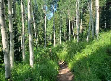
The Dog Lake ride reaches 8800 feet elevation. The expected
riding season is July through early October. The area is heavily forested
with aspen and fir, but there will be occasional breakout views of grand
mountain vistas. In mid-summer there are lots of wildflowers.
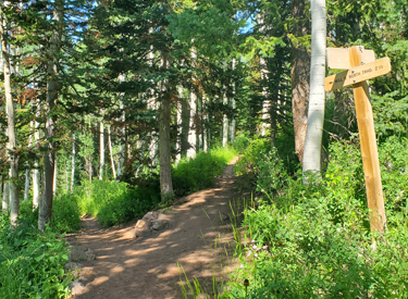
Plush riding on the Big Water trail as we climb
toward the Dog Lake trail in Mill Creek Canyon.
Although the trails are mostly smooth and well-maintained,
this is a moderately difficult ride due to the elevation and the sustained
pitch of the climbing. Most riders feel that the ride from Big Cottonwood
is harder than the trail in Mill Creek. I recommend this ride for
intermediates, although strong experienced beginners can manage the ride
from the Mill Creek Canyon side.
Looking north from the Dog Lake trail. Views are only
occasional, as the ride is heavily forested.
As you plan your Dog Lake ride, be aware that Mill Creek
Canyon is a fee area. Also, bikes are allowed on the Big Water and
Dog Lake trails ONLY on even-numbered days! The gate to Upper Mill Creek doesn't open until July.
(But by riding up the road or the Upper Pipeline trail, the Dog Lake ride can be
often done in early June.)
The obligatory "I was there" photo.
Required by law.
Getting to the trail!
Mill Creek Canyon
Lower Big Water trailhead. Get to Foothill Blvd on the east bench of Salt Lake City
via I-215. Exit at 39th South. Take 3800 South eastbound into the Canyon. Drive all the
way to the top of the canyon, where the paved Big Water Trail parking area will
be on your right. There's a bathroom here.
Via Upper Pipeline. From a trailhead such as Rattlesnake, Burch
Hollow, or Elbow Fork, pedal uphill on the pipeline until you reach Big
Water. Be aware that riders from the the Wasatch Crest may be riding too
fast to control their bikes -- and many of them are unaware that the
uphill rider has right of way, or are under the mistaken impression that
the trail is one-way!
Looking west in the lower Big
Water trailhead parking.
Big Cottonwood Canyon
Mill D North Fork trailhead. Go to Big
Cottonwood Canyon (Wasatch Blvd and 72nd South) and drive 8.8 miles up from
the traffic light. At Reynolds Flat, look for a parking strip on your
left.
Via the Wasatch Crest. From the Crest trail, descend the Mill D
North Fork trail 1.7 miles, then fork to the right on the Dog Lake to
Desolation Connector trail.
At the trail fork for the
Dog Lake to Desolation Connector trail, a way of reaching Dog Lake from
Big Cottonwood.
Mill Creek - Big Water Trail to Dog Lake
My recommended route in Mill Creek Canyon begins at the
lower Big Water trail. It will be 3.1 miles to Dog Lake with just under
1200 vertical feet of climbing.
Just getting started. Bruce cranks up the wide smooth
trail from the lower Big Water parking area.
You can begin the Dog Lake ride from either the upper or
lower Big Water parking lots. On weekends, you may need to use overflow
parking because Mill Creek gets crowded. My favorite is the lower Big
Water lot, climbing via the lower Big Water trail. This option is longer,
but not as steep as upper Big Water (see the map).
View uphill as we climb Big Water.
The upper Big Water and lower Big Water trails will rejoin
into a common trail just uphill from parking. The lower Big Water route is
0.5 miles, while upper Big Water is 0.3. The mileage on this page will
assume you're riding from lower Big Water.
Rolling a switchback turn. Note how wide the Big
Water trail is.
From the lower Big Water trailhead, the trail immediately
enters a dense fir forest. Keep to the right as a connector from upper Big
Water parking joins, then in 100 yards, keep left uphill on Big Water. The
trail on the right is the upper Pipeline, which will descend Mill Creek
Canyon.
View uphill in fir forest. The trail is broad and
smooth, and usually has plenty of room for riders to pass. Remember the
uphill rider has the right of way, so pull to the side and stop unless the
oncoming rider plainly signals that he wants you to keep going.
At mile 0.5, keep straight and right as the upper Big Water
trail joins from downhill. Now just keep cranking along the slope.
On the Big Water trail, there will be two wooden
bridges across small creeks as you climb toward the Dog Lake trail.
At mile 1.5, the Dog Lake trail separates
from the Upper Mill Creek Canyon (Great Western) trail. (The GW trail takes you another
1600 vertical feet uphill to the Wasatch Crest.) Fork to the right.
The Dog Lake trail is a bit narrower than the path up to
this point, but it's still a fairly plush trail that's easy to ride.
We're now on the Dog Lake trail portion of the ride.
It's 1.6 miles from the trail fork to the lake.
You may note the Little Water trail on the
map. Yes, it's an alternate route to Dog Lake but it's often push-a-bike steep.
Little Water crosses the Mill Creek Canyon trail 100 yards past the Dog
Lake trail fork.
Some riders use Little
Water or the Upper Big Water trails as descending routes back from Dog Lake.
They are significantly steeper
than the Big Water trail. Little Water should be considered an expert
descent because of the slope and dusty slippery riding surface.
Almost to the lake. The trail will cross a small rise
at 8800 feet elevation then descend into a bowl.
Dog Lake is a total of 3.1 miles from the lower Big Water
trailhead via the route I describe. Lake GPS is N 40° 40.064' W 111° 38.331'. At Dog Lake, kick
back and have lunch and plan your next step. There's a nice add-on loop into
Big Cottonwood Canyon -- see the description below.
Bruce arrives at Dog Lake.
Dogs are allowed on Mill Creek Canyon trails, but don't take Fido over the
ridge into Big Cottonwood Canyon! About 150 feet past Dog Lake, dogs are absolutely
outlawed. If you're caught with a dog in Big Cottonwood, you WILL be busted, you WILL go
to court, and the fine is NOT trivial!
Dogs are supposed to be on-leash on even-numbered days. But you'll
likely encounter a lot of dogs that find it hard to move out of the trail.
Be patient.
What description of Dog
Lake would be complete without a photo of a dog at the lake? Here Jackie, the Mad Scientist's biking-fool Jack Russell
terrier, plays on the shore of Dog Lake. August 10, 1999
As you descend from the lake, keep your speed in control and
approach turns with caution. Even on weekdays, there will be a lot of
hikers, dogs, and mountain bikers coming uphill. Mill Creek Canyon has a
long history of user conflicts, and you don't want to add to the
grievances! Play nice.
View looking back downhill on the Big Water Trail, about 1/4
mile uphill from the lower parking lot.
Dog Lake to Mill D Loop (add-on ride)
The mini-loop at Dog Lake lies on the Big Cottonwood side.
It can be done any day, not just even-numbered days. The loop is 2.5 miles
around, with 500 vertical feet of climbing. It can be done in either
direction, but I suggest clockwise, starting with the Dog Lake to
Desolation Connector.
Cranking past the lake to hit the loop ride.
The Dog Lake to Desolation Connector starts at the southeast corner of
Dog Lake, forking off the Dog Lake to Mill D Connector to the left. It
begins with a gentle climb, then descends gradually 100 vertical feet to
Mill D North Fork.
Beginning a gentle climb as we ride clockwise on the
Dog Lake to Desolation Connector.
The Dog Lake to Desolation Connector is a
beautiful trail.
Easy to ride with lush greenery all around.
There will be a couple of open spots where you can
get a
look around. Here we're looking up to the Wasatch Crest.
When you reach Mill D, consider an out-and-back to
Desolation Lake. This will add 3.3 miles and require another 400 vertical
feet of climbing.
Assuming you turned downhill to the right on Mill D, your next section
is 0.8 miles of downhill.
Dropping down Mill D North Fork. Pretty plush here,
with a log water bar just ahead. No problem.
The riding starts out mellow and scenic. But then you'll hit
some areas of steep trail that suffer from erosion. It will vary
year-to-year and with trail maintenance activities, but expect some
water-bar log drops, a few roots, and some embedded boulders. You'll drop
350 vertical feet, much of it in short steep segments, as you ride 0.8 miles
west on Mill D North Fork.
Here's a photo of a nasty steep section of Mill D
from a few years ago. Log water-control bars, embedded rock, and moon
dust.
At the intersection with the Dog Lake to Mill D Connector,
fork to the right uphill. This trail has been recently rebuilt, replacing
the old push-a-bike trench in the gully. It's now pretty plush, with a
strenuous but reasonable rate of climb.
Heading uphill on the Dog Lake to Mill D Connector.
The Dog Lake to Mill D Connector is 0.8 miles long with 400
vertical feet of climbing. It will bring you back to Dog Lake after the
Dog Lake to Desolation Connector trail joins on your right.
Crossing a bridge over the ravine.
Big Cottonwood - Mill D North Fork to Dog Lake
From the Mill D North Fork parking area near Reynolds Flat
in Big Cottonwood Canyon, you can ride uphill to Dog Lake. This is your
only Dog Lake option on odd-numbered days. Big Cottonwood trails have no
restrictions on the days you can ride. (The even-numbered days for bikes
only applies after you cross the little ridge north of Dog Lake, so you
can ride to the lake any time.)
View up Mill D North Fork Canyon from the trail.
From the Mill D North Fork trailhead, it's 2.7 miles to Dog Lake using the
Dog Lake to Mill D connector. If you climb higher on Mill D to the Dog Lake to
Desolation connector, it's 3.6 miles. There will be 1400 vertical feet of
climbing.
The Mill D North Fork trail is a combination of tough
steeps and mellow cruising. But it's a big of a grunt in the uphill direction so
I recommend it for strong intermediates or better.
The climb to Dog Lake from Big Cottonwood is significantly harder than the
route in Mill Creek, both in technical requirement and steepness. I consider it
an upper-intermediate ride.
We've arrived at the trail fork for the Dog Lake to
Mill D Connector. This is a common "stop-and-wait for the rest of the
guys" spot.
From the Mill D trailhead, climb 1.9 miles uphill, gaining 950 vertical feet.
This is a fairly stiff rate of climb. You'll now arrive at the trail fork for
the Dog Lake to Mill D Connector. Fork left for the shortest route to the lake,
or continue uphill on Mill D North Fork if you want to take the Desolation
connector.
Beginning the trip uphill on the Dog Lake to Mill D
Connector.
Via Dog Lake to Mill D Connector
Fork left at at mile 1.9 of Mill D for the Dog Lake to Mill D
Connector. The Connector trail is 0.8 miles long with 400 feet of elevation gain. It's a
stiff and constant climb. (This is not the old bottom-of-ravine trail older
riders may remember. The Connector has been completely rebuilt and is pretty
plush.) There will be wooden bridges across the creek.
The rebuilt trail is nice, with bridges crossing the
ravine as the trail winds back and forth.
A couple of the switchback turns are
a little abrupt, as though the trail crew ran out of time or money to polish
them for bike riders. Overall, this route from the Big Cottonwood Canyon road to
Dog Lake is 2.7 miles with 1400 vertical, which
is a taxing climb for most of us.
One of the more gentle switchback turns, seen from
uphill.
As you arrive at the lake, keep straight as the Dog Lake to
Desolation Connector joins on your right.
Almost there. We're approaching the ridgeline south
of Dog Lake.
Note that some riders who are descending Mill D North Fork from the Wasatch
Crest trail will take the Dog Lake to Desolation Connector trail. Then from Dog Lake,
they will descend the Dog Lake to Mill D Connector to continue on the Big Cottonwood side down to the
trailhead in Reynolds Flat. (On even-numbered days, you can go over the rise and
descend Big Water into Mill Creek.)
Seeing a bit of the lake as the Desolation Connector
joins on our right.
Via the Dog Lake to Desolation Connector
At the trail fork on Mill D North Fork's mile 1.9, keep right on Mill
D. Climb through some steep spots then enjoy some beautiful cruising. It
will be 0.8 miles with 350 vertical feet of climbing to reach the trail
fork for the Desolation Connector.
This
route may be easier overall than the Dog Lake to Mill D Connector because it
spreads the climbing over an additional mile, but there are some bumps and water
bars on steeper parts of the Mill D North Fork trail that may take you off your
bike.
Looking uphill on the Mill D North Fork trail near the
Desolation Connector.
At the Connector (mile 2.7 from the trailhead), consider a
trip up-and-back to Desolation Lake. Further uphill on Mill D, Desolation
Lake is 1.3 miles away and the Wasatch Crest is 1.7.
Desolation Lake, seen from the western shore.
From the trail fork at mile 2.7, turn left and begin a
gentle climb on the Dog Lake to Desolation Connector. After a short
distance, the trail will become a bench-cut on the hillside. The ride is
plush and easy. You'll gain another 100 feet of elevation as you head west toward Dog Lake.
Starting uphill on the Dog Lake to Desolation
Connector.
The Dog Lake to Desolation Connector is mostly forested,
with aspen and pine sharing the slope with luxurious undergrowth. There
will be a couple of spots that break open for views.
A rare view to the south at the mountain ridge
between Big and Little Cottonwood Canyons.
As you get close to Dog Lake, the trail will slope gently
downhill for the final 1/10th mile.
Heading west on the Dog Lake to Desolation Connector.
Keep right at the fork with the Dog Lake to Mill D Connector
and in 100 feet you'll be at Dog Lake.
My suggestion is that you select one route for the climb, and take the other
option downhill. This forms a lariat loop ride of 6.3 miles total.
And we're at the southeast corner of Dog Lake.
Video of the Big Water
ride up to Dog Lake
If the above video does not appear on your
browser/device, you can watch it on YouTube by clicking
here.
Getting there, Mill Creek Canyon: Get to Foothill Blvd on the east bench of Salt Lake City
via I-215. Exit at 39th South. Take 3800 South eastbound into the Canyon. Drive all the
way to the top of the canyon, where the Big Water Trail parking area will be obvious at
GPS N 40° 40.922' W 111° 38.914'.
Note: the gate to upper Mill Creek Canyon is
only open
to cars from July 1 to November 1. Mountain bikes are only allowed on upper Mill Creek trails
on EVEN numbered days! There is a fee of $5 per car, $3 for seniors (2022),
payable by card -- no cash or checks.
Big Cottonwood Mill D North Fork: Go to Big
Cottonwood Canyon (Wasatch Blvd and 72nd South) and drive 8.8 miles up from
the traffic light. At Reynolds Flat, look for a parking strip on your
left. GPS N 40°
38.976' W 111° 38.884'.