 |
Forebay upper trail details
This page provides photos and details for specific trails in the upper Forebay trail system. Trails are listed in alphabetic order. For
trailheads and general information, see the Forebay
main page. See also the Forebay Lower Trails info page.
The upper trails are those above the Overlook trail and the reservoir access road (which goes
0.8 miles from the Nebo Loop Road to the reservoir).
Photos from rides by Bruce from 2015 through 2021. |
 |
Broken Collar Bone (BCB), together with the Rattlesnake Tree
trail, connects Salem Hills Drive in Elk Ridge to Kaya in the Forebay system. The combined route is 2.4
miles, with the northern 1.4 miles being BCB.
At this gate, Rattlesnake Tree ends and BCB continues
straight north.
|
| Broken Collar Bone winds back and forth to climb up and over
a ridgeline as it passes from lower Payson Canyon to Elk Ridge. The
climbing pitch is gradual, and the trail is narrow but smooth.
The total climbing will be just over 200 feet to get from
Forebay's Kaya trail to the ridgeline above Elk Ridge, after which you'll
descend 100 vertical to end in a neighborhood without a formal trailhead.
(You can park on the shoulder along Salem Hills Drive. At some future
time, the gravel road at the Elk Ridge end of BCB will become
subdivision.)
Climbing through dry scrub on the south side of BCB.
|

|
 |
BCB is an intermediate-level trail, similar to the other
Forebay trails. There will be the occasional pedal-catching stump and
handlebar bang. For a trail that goes nowhere except to homes, the trail
seems well-maintained and there's evidence of a a
surprising amount of bike traffic. Broken Collar Bone is worth
riding as an out-and-back from Forebay.
There will be some maple and oak forest.
|
 |
 |
Some very friendly horses that wanted to
say hello and
investigate
the delicious smell from my Gatorade bottle. |
A lookout bench within the radius of a
turn. At this spot,
I'm
on my way down to the Elk Ridge neighborhood. |
| To get to BCB from Forebay, you'll need to get uphill on
Kaya. From the
south, you'll take Jax to climb up to the top of Kaya and descend to Rattlesnake Tree.
After a mile, Rattlesnake Tree turns into BCB at a property border. Go
through the gate. Ignore the ATV track along the fence and find the
singletrack heading north straight away from the gate. (Note that this
access goes into an area slated for subdivision construction, and may be
not be open for passage. If you're unsure, visit a local bike shop, buy
something and ask.)
View northeast at Elk Ridge as we wind down from the
ridgeline.
|

|
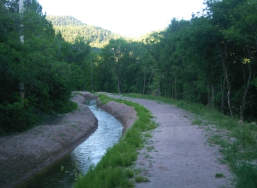 |
The Canal Trail runs from the east Maple Dell parking lot to
the reservoir. It's 1.3 miles long and is pretty flat. At
Maple Dell parking, you'll see the canal curving around the east side. On the
north side, there's a gate on gravel road just west (left) of the canal.
Step around the gate and start riding. The trail will rapidly turn to dirt
and become narrow.
Note: the Pine Forest trail (uphill and
across the road from the main Forebay parking) can be used to loop back to
Maple Dell.
Heading back to the parking lot on the Canal Trail. |
| The Canal Trail ends at a small divided reservoir. The easiest way
to find the trail system is to fork 90 degrees left, just as you reach the
ponds. As you get to the second pond (which may be empty), fork hard left
downhill to go southbound on gravel road. This is the Access Road. The Overlook
trail will be on your right about 300 feet downhill.
You can connect to Jax at the pond
by forking to the right and dropping down the canal bank to doubletrack.
About 200 feet later, just before another doubletrack joins, the Jax trail
will be on your right.
Looking north as the Canal Trail
reaches the reservoir. Two ways to get to the Overlook Trail: after
first going left, you can go north to reach the north end of Overlook, or
you can go south to catch the south end.
|

|
 |
The Jax trail connects doubletrack on the uphill side of the
reservoir to Taze (a short alternative route off Ray Gun). The main
purpose for Jax is to reach the south side of the Kaya trail. Jax is 0.4
miles long. Jax starts on the east (uphill) side of the reservoir with ATV
trail, then the Jax singletrack forks right to climb to the Kaya trail
fork before descending to Taze.
Looking north.
|
 |
Update July 2021
Permission to ride Karl's loop has been withdrawn by the property
owner.
Karl's Loop lies at the northern end of the upper trail
system. It's 1.8 miles around the loop. Karl's is reached via Ray Gun and Lariat. After
riding the Lariat loop, take the connector at the northern end 0.1 mile to rejoin the
ATV track as it
goes through a gate.
On Karl's Loop, heading south. |
|
Now again find the singletrack just beyond the gate. You're now
entering the stem of Karl's loop. A short distance later, the trail will
split. There were no trail signs here as of June 2015. Forking right feels most
natural, so keep right and continue uphill. You'll do the loop
counterclockwise.
There are game and stock trails through this area. On my check-out
ride, Karl's was the
least-defined trail of the system. The loop
will very briefly join ATV track in three spots. But I didn't have any trouble navigating.
"Competing trails" had a branch dropped across them to indicate
the proper path.
View over the golf course from Karl's
Loop.
|

|

|
Kaya forms a one-mile arc on the upper mountain, reaching the highest
elevation within the system at 5800 feet. The north end of Kaya is just across the ATV path
from Ray Gun, with the south end on Jax.
When starting from the north end of Ray Run, the average rate of climb
on Kaya is around 400 feet per mile, but only
1/3 mile is sustained climbing. On this northern side, just below the peak
elevation, the Rattlesnake Tree trail forks away.
Looking towards Timpanogos and Cascade
Mountain on Kaya, near the ride's highest point at 5800 feet.
|
|
Kaya will twist and undulate through the forest, traverse south, then
descend. Kaya will hit Jax near the Jax trail's south end. You can fork right uphill,
as you'd only be missing about 200 feet of Jax singletrack (which just
goes down to ATV track). Northbound, Jax will end on Taze. See the map.
Wild turkey along the trail.
|

|
 |
Update July 2021
Permission to ride Lariat has been withdrawn by the property owner.
When Ray Gun hits an ATV track, keep left and find the
continuing singletrack around 100 feet later on your left. This is the
entry to Lariat. Lariat is a loop with a stem on each end. The loop itself
is 1.2 miles. The southern stem comes from Ray Gun, and the northern stem
goes to Karl's.
After leaving the ATV track to enter the Lariat singletrack, the next trail fork is the
loop.Consider whether you want to do a
loop-de-loop, or pick up the connecting piece on your way back from Karl's.
View to the north on the Lariat trail
loop.
|
|
For a loop-de-loop (repeating about 1/3 mile in the middle) keep right,
then take the next left. You'll come back to your original trail fork,
where you'll turn left to repeat a section of trail. Then you'll keep right and northbound at the next
fork to go on to Karl's.
To hit only the lower longer part of the loop and skip the upper
portion, fork left. At the end of
the loop (the next trail fork), turn left and head north to Karl's. You
can hit the upper connector on the way back by keeping left at the loop
trail fork.
Note the shoulder-high grass. Much of
Utah was like this before overgrazing damaged the hillsides. |

|
 |
Overlook is 0.5 miles long. It's the usual route for
connecting between the lower Forebay trails and the upper ones. It arcs to
the west around the reservoir. When climbing Overlook, the Round Top trail
forks away to the left west of the reservoir.
View north from Overlook as we cross the ridge near
the origin of Round Top.
|
| Overlook originates on the reservoir access road, around 100
feet uphill from the end of Favorite. The fork to Round Top comes after
0.3 miles.
Round Top from the reservoir access road. The
sage-covered slope above is the fill for the reservoir.
|

|
 |
Overlook heads east after it passes around the reservoir,
running through a large grass meadow. It will hit ATV trail as it goes
through a sharp dip. On the east side of the dip, the Ray Gun trail forks
to the left.
In the grass flat north of the reservoir. We'll veer
to the right and head for the trees to reach Ray Gun.
|
 |
Rattlesnake Tree forks away from Kaya on the northern side,
just downhill from the highest elevation. It traverses one mile north before becoming the Broken Collar
Bone (BCB) trail.
Riding north on Rattlesnake Tree shortly after
leaving Kaya.
|
| When the trail hits a gravel road, keep uphill to the right
and find the continuing singletrack on the other side of the road.
The Rattlesnake Tree. No snakes today.
|

|
 |
When Rattlesnake hits a metal gate, it continues as BCB on
the other side, heading straight away from the gate. Rattlesnake is
more dry terrain than the rest of Forebay.
|
 |
Ray Gun is 0.5 miles long, heading north between the
Overlook Trail and the ATV track on which Lariat starts. In the middle,
the short Taze trail forks away and rejoins. (Get onto Taze if you're want to connect to
Jax.)
View back to the south.
|
| At the northern end of Ray Gun, you can cross the ATV track to
Kaya, or
turn left onto the doubletrack and find Lariat on your left around 100 feet down
the ATV path.
Ray Gun is fairly straight and mostly forested.
|
|
 |
Round Top is a 0.6 mile lariat loop off of the Overlook
trail. It's a nice little ride with terrific views. But it's also
important for its connections to the Wakara
loop and to the top of the Trotter trail. Westbound on Round Top, where the terrain changes to add a bit of rock,
bitterbrush, sage, and oak. |
| This loop is dryer and more open than most Forebay trails, with some rough
granite rocks.
View south up Payson Canyon from Round Top.
|

|
 |
Just before Round Top splits into a loop, the Trotter trail forks south
(left) and the two limbs of the Wakara loop fork away on your right.
Heading into the turn of the loop on Round Top.
|
 |
Taze is a 0.1-mile alternate off Ray Gun. Toward the
northern end, there's an uphill connection to Jax.
Taze is mostly tree-lined. |
 |
Wakara is a 2.3 mile loop that drops through a shallow
valley and climbs to the ridgeline to the north. It starts on the Round
Top lariat loop. The trail is narrow dirt singletrack and easy to ride.
Entry to Wakara, if riding the loop counterclockwise.
|
| Wakara can be done either direction. The ride first descends
off the ridgeline of Round Top into a broad flat valley. There it winds
back and forth between stands of gambel oak. This area will be wet and
sticky in springtime.
In both directions, the trail passes over a broad
flat valley between low ridgelines. Looking north.
|

|
 |
At the far north end, the trail climbs up to a ridgeline
where you can see views of Utah Valley to the north. For a short distance
there's a bit more
rock in the trail, but overall the trail is still very easy.
View north on the ridge, just before turning back to
the south. |
| Total climbing over the course of the loop is only around
150 vertical feet. There's 50 at the northern end, then 100 to climb back
up to Round Top on the ridgeline.
On the way back, with views of Payson Canyon to the
south. |

|
| Upper Trails (above reservoir Access Road)
Orange Gate access road: 0.8 miles from Nebo Loop Road to reservoir.
Canal Trail: From Maple Dell parking to reservoir, 1.3 miles
Broken Collar Bone: 1.4 miles from Salem Hills drive to property line
gate, continues as Rattlesnake Tree
JAX: 0.4 miles arc from Taze to reservoir DT, connection uphill to Kaya
Karl's Loop (closed per property owner): 1.8 mile loop at northern end of system, reached via Lariat
Kaya: 1-mile arc on hillside from Taze to JAX, connection to Rattlesnake
Tree
Lariat (closed per property owner): 1.2 mile loop ride from top of Ray Gun, with connection north to Karl's
Loop
Overlook: 0.5 miles from upper Access Road around reservoir to Ray Gun,
connection to Round Top
Rattlesnake Tree: 1 mile from northern Kaya, continues as Broken Collar
Bone
Ray Gun: from Overlook above reservoir to Lariat and northern end of Kaya,
connections to Taze
Round Top: 0.6 mile lariat loop from Overlook, with connections to Wakara
loop and top of Trotter
Taze: 0.1-mile alternate off Ray Gun with connection to Jax
Wakara: 2.3 mile loop off Round Top
See the main Forebay page for trailhead
details and other resources! |

|

|


