 |
More Hoes More Hoes is a
four-mile advanced technical mountain biking singletrack that climbs to a mesa top
overlooking US-40 in the McCoy Flat trail system
west of Vernal. To reach More Hoes, you need to ride a
bit of the Got Milk trail and return via
Retail Sale. The minimum ride is
7.3 miles. With Retail Sale as an optional return, the ride becomes 12.1
miles.
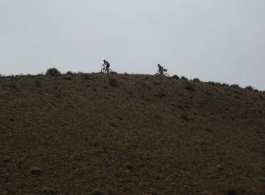
Bruce rolls over a rise early in the
ride. Photos May 26,
2010 by Jake Weber, Gene Poncelet, Steve Winters, and Bruce. |
|
The actual More Hoes bike trail has only 350 feet of absolute
elevation change, but up-and-down riding will add up to 800 vertical feet
of climbing. There are some grunt climbs, loose corners (both uphill and
down), and a few tricky spots. This makes More Hoes a ride for experts.
Steve cruises away from the junction
with Got Milk. Soon desert cruising will turn to technical riding. |

|
|

|
The ride starts on the Milk and Cookies loop, which is
also the Retail Sale loop. The trail is one-way -- counterclockwise. At
the fork where Retail Sale splits off (mile 1.3) keep straight (right).
Pass the faint High Rollas and More Pimps that forks sharply on the right 50 feet later,
and continue to the westbound Got Milk singletrack on the right 100 feet
past the fork.
Bruce finishes off a stair-step
descent with a ledge drop. |
|
At mile 1.5, More Hoes forks off of Got Milk on your left.
The trail will wander around, up and down. At about mile 2.5, the trail
gets serious about climbing up the mesa. After a brutal 1/2 mile, you're
on the mesa top.
Joel Quinn drops down a tight spot
between the boulders as Bruce looks for the photo above. |

|
|

|
The trail skirts the edge of the mesa, looking down at
US-40 underneath, then turning south along the drop-off. The mesa ends in
a narrow ridgeline. This is a fun spot, although the round (and often
loose) boulders add to the challenge.
The up-and-down riding will soon give
way to a grunt climb to the top of the mesa. |
|
At the far south end, the trail drops sharply down. Now
you understand why this is a one-way loop. A few more ups-and-downs, and
you rejoin Retail Sale, just 1/10th mile from the fork where you veered
off. The mesa has views in all
directions. 
|
|
|

|
After More Hoes, Retail Sale will seem positively tame.
Follow it eastbound. Pass the Fire Sale merging trail at mile 6.2. At 6.9,
you can either fork left to go back to the trailhead, or continue another
five miles on Retail Sale for a longer ride.
At the south end of the mesa, the
trail threads along the top of a sharp ridge before plunging down. |
|
Riding notes, shorter More Hoes loop:
0.0 From corral parking, cross road to DT
0.1 Fork R on ST (alt = 2nd ST on R)
0.3 Rejoin alternate ST
1.1 Keep R (L = Fire Sale) N40 20.830 W109 35.982
1.3 Trail merges with ATV track
Keep R at fork (L = Retail
Sale) N40 20.716 W109 36.093
1.35 Pass ST on R (High Rollas)
Take ST on R 100 feet past
Retail Sale fork
N40 20.711 W109 36.120
(Continued next panel...)
After the first big plunge, the
descent gets more fun. |

|
|

|
(More Hoes, ride notes continued...)
1.6 Fork L (R=Milk and Cookies) N40 20.811 W109 36.348
3.0 Reach mesa top
4.6 Drop off mesa
5.7 Fork R on Retail Sale N40 20.644 W109 36.091
6.2 Keep R as Fire Sale joins N40 20.616 W109 35.647
6.9 Fork L to return (R = Retail Sale optional return)
N40 20.759 W109 35.083
7.2 R on DT
7.3 Back at corral parking
An interesting trail section near the
end,
as the trail hugs a slope that is like petrified melting ice cream. |
Getting there:
While driving toward Vernal on US-40, pass mile marker 138, then turn
right on the narrow paved McCoy Flats road ( N40 23.427 W109 35.752). If
you miss McCoy Flats road, go to the viewpoint overlooking Vernal and
backtrack exactly 2 miles, then turn left into the road. Drive 3 miles.
Immediately after passing a corral on your left, turn into the large
fenced BLM trailhead parking lot.
Camping: BLM land, primitive camping allowed. No developed
sites.
Bathroom: At trailhead
Water: Bring your own.
Bike services, maps, trail conditions:
Altitude Cycle, 580 East Main, Vernal. 435-781-2595 |

|

|


