 |
Timpanogos Foothill East Trails
Taj Mahal and Machu Picchu loop optionsThe Taj Mahal, Machu Picchu,
and Ouch trails lie northeast of the more popular Timpanogos
foothill trails at the mouth of Provo Canyon, higher on the slope. If I were feeling kind,
I might describe these routes as "adventure trails" for expert
riders looking for fresh territory. They are primitive and often hard to
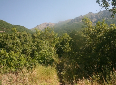
ride. Eastbound toward the southern flank of Mount
Timpanogos. Photos and ride track by Bruce on July 12 (Machu Picchu ride)
and July 26, 2016 (Taj Mahal ride). |
|
NOTE! These trails have been designated as
closed to bike riding. I'm leaving this page here only because some trail
runners use this website as a resource to evaluate trails they might want
to do on foot. Mountain Bikers, please respect the trail closure. Thank
you.
The trails have been renamed "Ruffy"
and "Moose Back."
|
|
On this page, I describe two rides. One hits Machu Picchu and western
Ouch from the Bonneville Shoreline trailhead at Canyon Glen in Provo
Canyon. From
any trailhead, it will take 1500 vertical feet just to reach Machu Picchu.
This lariat loop (with a once-around on the Ouch Circle inside the
loop) is 8.4 miles with 1800 vertical of overall climbing.
The second ride, also starting from Canyon Glen, makes a big loop
west-to-east on Taj Mahal, with a DH cutoff bypassing Dragon's Back on the
way down. This ride is 6.5 miles with 1600 feet of climbing.
If you don't like the climb up to Dragon's Back from Canyon Glen and
detest Frank (Trail 033) -- and who doesn't -- you can get to the area via
a longer but more mellow alternative. For example, you can take Shooter
from the Orem BST trailhead, climb the West Ridge to the Trail 51 area,
then take eastbound trails to the Little Baldy trail to link up. Or you
can take the Bench Road to Betty for your climb.
View northwest from the eastern side of Taj Mahal.
|

|
 |
These trails require an adventurous attitude. And strong
legs. And expert biking skills. And a tolerance for scars. For both rides,
I came home thoroughly scratched up, just from the oak raking my arms and
legs. On the Machu Picchu ride, oak brush caught and ripped the handlebar
around, dumping me over the top (twice!). There's injury potential here,
and no riders nearby to help.
So if you're the sort who gets angry, says many bad words, and plots to
murder the website author who told you about the trail you're riding,
DON'T ride these trails. They're mean!
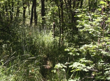
Real honest non-photoshopped view straight down the
trail on a piece of the Taj Mahal route. |
 |
Taj Mahal
Taj Mahal itself is 2.5 miles in length from Little
Baldy trail 33 to its end on the Alta Ditch (Orem Bench) road. The
western end starts at 6200 feet elevation, descends then climbs again to
6300, then drops steeply to the dirt road where the eastern end is 5600
feet elevation.
The tread is narrow but mostly of reasonable width, but encroaching
scrub oak scratches arms, yanks at handlebars, and hides rocks and stumps.
The track tends to go up-and-down (horse-route style) rather than
contouring around rollers on the slope.
The Rocky leans on a limestone rock on Taj Mahal. |
 |
Ouch
Not sure if Ouch is the real trail name, or just Trailfork's reaction
to riding it. I used some other four-letter words while forcing my bike
eastbound on this rough and primitive route. Ouch is 1.3 miles long, forking
north uphill from Taj Mahal 0.2 miles from Little
Baldy, then rejoining at Taj Mahal's midpoint.
Ouch will climb from 6300 to 6500 feet elevation before dropping back to 6300
at the eastern junction with Taj Mahal. The eastern half of the trail is
especially narrow and often rough from embedded rock. When only the
western side is used for a loop ride, it's not horrible. Meadows alternate
with stands of scrub oak.
Looking west on a smooth spot where Ouch crosses a
meadow. |
 |
Ouch Circle
This alternative line lies on western Ouch between the Machu Picchu
fork and the Taj Mahal fork. It's some of the smoothest riding in the area
as it winds through maple forest and meadows. The eastern end is higher by
100 feet, but the rate of climb seems pleasant.
The Circle is 0.8 miles around, consisting of 0.5 miles on the uphill
alternate line plus 0.3 miles of Ouch between the two ends.
Trust me, there's a trail there. Middle bottom of the
photo.
|
 |
Machu Picchu
This trail forks east from a switchback on Little
Baldy uphill from Trail 51 at just over 6600 feet elevation. It
descends 150 feet over 0.6 miles to end on Ouch, 0.5 miles from where western
Ouch ends on Taj Mahal. Like Ouch, the trail is narrow and bumpy
from embedded rock. It lies almost entirely in tall maple forest.
In the ride below, I take Machu Picchu west-to-east downhill, then the
western end of Ouch in a clockwise circle downhill. (I also did this
segment uphill, but both the riding and navigation were much trickier.)
Narrow trail in the grass in a grove of maple. |
 |
The ride starts at the footbridge over the Provo River near the entry to the Canyon Glen parking. Your starting altitude is
around 5000 feet. Turn right at the paved Provo
River Parkway and go about 200 feet uphill.
The Bonneville Shoreline Trail (Trail 33)
forks uphill on the left, just as the trail is approaching a rock outcrop.
Immediately it begins a stiff climb uphill.
Here's your route to the Parkway from the Canyon Glen
parking lot. |
| Some riders can grunt their way to the top without a break.
Most of us will need a couple of breaks to recharge the muscles. And
perhaps a short push-a-bike or two. The trail will make a
switchback turn left uphill after it joins the pipeline corridor eastbound
for a few feet. (The continuing route east would take you to Nunn's Park.)
There's 230 vertical feet of climbing
over 0.4 miles up to the Bonneville Shoreline bench.
Now you'll reach a flat area. Keep straight and left for the Dragon's
Back. (The trail to the right passes through Johnson's Hole before
climbing steeply uphill to rejoin Dragon's Back near the Orem Bench Road.) You'll
quickly begin climbing again, working up the ridgeline westbound, then
northbound.
The BST heads toward the Dragon's Back westbound.
|

|
 |
Keep straight and northbound as Johnson's Hole comes in on
your right. The trail will join gravel road at a metal gate at mile 1.5.
Go up to the Bench Road and a second gate and turn left. After 0.3 miles
on the Bench Road, Trail 33 (signed for Little Baldy and GWT) forks uphill
on your right.
Locals call this trail "Frank." Frank is an older route, in
serious need of rehab and/or reroute. There's plenty of loose rock and
overgrowing oak. The first half-mile is miserably steep and loose, then
Frank becomes marginally more pleasant. Overall you'll climb 500 vertical
on Frank's 0.8 miles.
Frank (GWT, Trail 33) climbs from the Bench Road.
|
| Frank ends at The Altar (mile 2.6 from the TH), a pile of
rocks where several trails come together. Turn right to head north uphill
on Little Baldy trail 33.
Here again, there will be some steep areas with loose rocks on the
eroded trail surface, and occasional encroaching oak scratching at your
arms.
|
|
 |
At 0.3 miles from The Altar, as the Little Baldy trail turns
a bit to the left, a faint singletrack forks to the right. You've reached
Taj Mahal.
The trail will go east-northeast over some rollers, generally climbing.
At 0.15 miles from the Little Baldy trail, there's a critical trail fork.
A cairn and a row of rocks would send you to the left (northeast) uphill. NO!
That's Ouch. If you're suckered into taking this left fork (as I was),
you're going to find some unpleasant trail ahead.
Heading east on Taj Mahal, before the Ouch fork.
|
| Instead, go straight and right through a small passage in the oak
brush. Follow this right fork as it turns and goes downhill to the
southeast. If you become alarmed that you're descending too far so you
must be on the wrong trail -- you're
probably on the RIGHT trail.
You're going to lose about 200 vertical feet of that elevation you
fought so hard to reach, continuing to lose altitude as the trail turns back eastbound.
View towards crags on Timp's southern slope from the
Ouch trail fork area. There should be no further trail forks on Taj Mahal.
If you quickly pass a couple of routes forking left (uphill), you're
probably on Ouch.
|

|
 |
The trail will now begin a long stretch where it contours
the mountain eastbound as it slowly regains the lost altitude. The tread
here is fairly good, but with occasional oak grabbing at your shins and
hands.
Over the next 3/4 mile, you'll regain almost all of the altitude you
lost after descending from the Ouch fork. You may (or may not) see Ouch
rejoin Taj Mahal on your left at mile 4.2 (1.1 from the Ouch fork).
Looking to the southwest at the mouth of Provo Canyon as the trail
crosses a ridgeline clearing on steep side-slope. |
| After another half-mile of traverse eastbound, Taj Mahal
will begin descending through a series of turns in tall maple forest. Big
limestone boulders stand near the trail. This is the best riding of the
trip. Enjoy it while it lasts.
The trail meanders through huge limestone boulders
under maple forest.
|

|
 |
Now the trail starts descending steeply into Provo Canyon in
stunted oak scrub.
It's a bit too steep to enjoy the downhill, as you'll lose 600 vertical
feet in 0.8 miles.
In the middle of this downhill, the trail meets an old doubletrack and
turns hard right. Now follow the DT 0.4 miles down to the Alta Ditch (Orem
Bench) road.
Here the trail begins its eastbound plunge into Provo
Canyon. |
| As you reach the gravel road, keep straight to head back to
the west. From here, you could return back to the Bonneville Shoreline
fork (at the metal gate) and descend the way you came.
My (shorter) track takes you 0.4 miles west on the gravel road, then
plunges down a singletrack on the eastern edge of Johnson's Hole. Watch
for the singletrack dropping off the left side of the road, just as it
reaches a wide area with a shoulder.
We've reached the junction of the gravel road with
the doubletrack descent from Taj Mahal.
|

|
 |
This singletrack is nice at first, then plunges quite
steeply down to the Johnson's Hole trail, just a few feet from the
Dragon's Back trail. Turn left, and descend the remaining 0.4 miles back
to the trailhead.
Looking northwest from the spot where Dragon's Back
meets Johnson's Hole. That's the Johnson's Hole trail.
|
Ride synopsis:
6.5 mile loop ride clockwise, 1600 feet of climbing. Rough trail surface,
steep climbs, encroaching brush.
Canyon Glen to Provo River Parkway. BST (Dragon's Back) to Orem Bench
Road. Road to Frank (Trail 33). At Altar, uphill on Little Baldy (33) to
Taj Mahal 0.3 miles uphill.
Critical trail fork for Taj Mahal 0.15 miles from Little Baldy, right and
downhill.
Steep descent to gravel road, then east 0.4 miles. Left downhill on
singletrack to fork with Johnson's Hole and Dragon's Back trails.
Retrace to trailhead. |

|
Riding notes, Taj Majal loop from Canyon Glen:
0.0 Cross Provo River N40 19.771 W111 37.277
0.1 R on Provo River Parkway
N40 19.814 W111 37.289
0.2 L on BST ST N40 19.901 W111 37.266
0.35 Join benchcut then L uphill
N40 19.899 W111 37.264
(R and level = east to Nunn's)
0.6 Keep L (R = Johnson's Hole)
N40 19.909 W111 37.390
1.4 Keep L (R = Johnson's Hole)
N40 20.122 W111 38.220
1.5 Around gate, up DT to Bench Road
L on Bench Road N40 20.170 W111 38.254
1.8 R uphill on Frank (Trail 33)
N40 20.184 W111 38.549
|
2.7 Altar. R uphill on Little
Baldy 33
N40 20.632 W111 39.060
2.9 R on Taj Mahal N40 20.766 W111 38.891
3.05 R and downhill (L = Ouch)
N40 20.777 W111 38.757
4.2 Straight and R (L = Ouch)
N40 20.622 W111 37.756
5.0 R on DT N40 20.398 W111 37.102
5.4 Straight on Bench Road
N40 20.192 W111 37.158
5.8 L on ST N40 20.138 W111 37.387
6.1 L at Johnson's Hole trail and
L to BST downhill N40 19.909 W111 37.390
6.5 Back at parking |
Machu Picchu and Ouch with Circles |
 |
From Canyon Glen, go across the Provo River. Turn right on
the paved Provo River Parkway trail. Now turn
left uphill on the Bonneville Shoreline Trail,
also signed for Trail 33.
Cross the level trail at the pipeline, mile 0.3 from the trailhead.
Keep left at the fork with Johnson's Hole at mile 0.6, having gone 230
vertical feet in the last 0.4 miles. Straight ahead is the climb up the
Dragon's Back.
Keep left again at mile 1.4 when Johnson's Hole rejoins uphill. Keep
straight and climb up around the metal gate, up the gravel road. Turn left
on the Orem Bench road.
The Bonneville Shoreline Trail, looking west shortly
after beginning the climb from the paved parkway trail.
|
| Go 0.3 miles west on the Bench Road, then turn right uphill
on Trail 33, signed for Little Baldy but called "Frank" by
locals. Grunt steeply uphill on loose rock, as encroaching oak tries to
catch you, gaining 500 vertical feet over the 0.8 mile.
This steep south-facing hillside can be unpleasant climbing on a hot
summer day.
View up "Frank" as we climb 12% average
slope in the first half mile from the Bench Road.
|

|
 |
At mile 2.6 from the trailhead, Frank comes to the big pile
of rocks called The Altar. Turn right (uphill, north) on Little
Baldy 33. The trail will become rough and steep.
Pass the connector to Taj Mahal at mile 2.9. At mile 3.2, keep right as
Trail 51
forks to the left.
Climbing higher on Little Baldy.
|
| At mile 3.6 from the trailhead -- almost exactly one mile
uphill from The Altar -- Machu Picchu forks to the right. This occurs as
Little Baldy is taking a sharp switchback turn to the left. (If you end up
on a long traverse east before hitting a sharp switchback to the left,
you're one turn too high.)
A mellow cruising spot on Machu Picchu heading
southeast.
|

|
 |
Machu Picchu runs east-southeast through maples and box
elder right where the mountain transitions from steep slope to tilted
bench. The grassy understory is a bit bumpy with embedded rock as a very
narrow trail runs through the tall trees.
The trail descends 150 vertical in 0.6 miles before dropping onto Ouch,
mile 4.2 from the trailhead.
We're about one maple grove away from joining Ouch. |
| The curve in Machu Picchu just before the Ouch intersection
tends to send you westbound -- a right fork. Good. In fact, you might not even
be aware you passed a trail fork, because this is the direction most
people ride. Few venture further east on Ouch, because it's nasty.
This westbound section of Ouch is pretty plush
compared to that that lies further to the east.
|

|
 |
This area of Ouch consists of small meadows mixed among
groves of maple and oak. Assuming you were even aware you passed the fork
and are on Ouch, the next trail fork is the top of the Ouch Circle, 1/10th
mile downhill. For now, keep left and go past.
Looking back to the east (up Provo Canyon) from a
meadow on Ouch. |
| At another fork after 0.3 miles, go to the right uphill on the
Ouch Circle trail. It will take you uphill in a tall clockwise loop. This
is some pretty trail, narrow but with a fairly open understory, mostly free of
scratchy stuff.
You'll rejoin the main Ouch trail after 0.5 miles, turning right to repeat the 0.3
miles you did before. This time, as you reach the spot where you entered
the loop keep left and straight to continue
downhill on Ouch.
The Ouch Circle winds through groves of mostly maple
with the occasional oak.
|
|
 |
The trail drops to the south through oak and small meadows.
When you see a cairn straight ahead and a long row of rocks just off the
trail on your left, you've reached the fork between Taj Mahal and Ouch.
Here you see the reason for the prominent trail marking. If you take
the left fork, you'll wind up eastbound on Taj Mahal. Maybe that's your
objective. But for this ride, fork to the right for westbound Taj Mahal.
We're coasting downhill on the last section of Ouch
toward Taj Majal. The terrain has turned dryer, so it's mostly oak and
grass. |
| The next 0.15 miles is rolling grass and oak as you go
westbound on Taj Mahal. It's generally
downhill but with bursts of climbing.
When you hit the Little Baldy trail, turn left downhill.
On Taj Mahal headed west toward the Little Baldy
trail.
|

|
 |
Now retrace your path: Down Little Baldy. Left at The
Altar for Frank (continuing trail 33). Just about all of the singletrack
now involves a bit of rock-surfing and oak-brush arm-raking. At the
bottom of Frank go left on the Bench Road. Turn right downhill on gravel road at the metal
gate, then left of the next metal gate to enter the Dragon's Back
singletrack.
Take either Johnson's Hole or Dragon's Back, your call. Now descend the
BST back to the paved parkway.
Looking uphill on Frank. More rock than dirt.
|
Ride synopsis:
8.4 mile lariat with loop and loop-within-a-loop at the top (done
clockwise), 1800 feet of climbing. Rough trail surface, steep climbs,
encroaching brush.
Canyon Glen to Provo River Parkway. Bonneville
Shoreline Trail (Dragon's Back and Orem Bench Road) to Frank (Trail
33). At Altar, uphill on Little Baldy (33)
to Machu Picchu one mile above The Altar.
Machu Picchu turns onto Ouch westbound, loop on Ouch Circle while
westbound. Critical trail fork 0.2 miles from western loop fork, keep
right to join Taj Mahal westbound.
After returning to Little Baldy, retrace your path downhill. |

|
Riding notes, Machu Picchu loop from Canyon Glen:
0.0 Cross Provo River N40 19.771 W111 37.277
0.1 R on Provo River Parkway
N40 19.814 W111 37.289
0.2 L on BST ST N40 19.901 W111 37.266
0.35 Join benchcut then L uphill
N40 19.899 W111 37.264
(R and level = east to Nunn's)
0.6 Keep L (R = Johnson's Hole)
N40 19.909 W111 37.390
1.4 Keep L (R = Johnson's Hole)
N40 20.122 W111 38.220
1.5 Around gate, up DT to Bench Road
L on Bench Road N40 20.170 W111 38.254
1.8 R uphill on Frank (Trail 33)
N40 20.184 W111 38.549
2.7 Altar. R uphill on Little Baldy 33
N40 20.632 W111 39.060
2.9 Keep L (R = Taj Mahal)
N40 20.766 W111 38.891
|
3.2 Fork R (L = Trail 51) N40 20.905 W111 38.970
3.6 Fork R on Machu Picchu
N40 21.114 W111 38.810
4.2 R to join Ouch N40 20.871 W111 38.426
4.3 Keep L (R = loop return)
N40 20.891 W111 38.495
4.5 Fork R to begin circle
N40 20.851 W111 38.667
5.0 Keep R (finish loop, rejoin Ouch)
5.3 Keep L (R = to circle again)
5.45 Fork R, westbound Taj Mahal
N40 20.780 W111 38.759
5.6 L downhill on Little Baldy
5.8 L on Frank at Altar
6.6 L on Bench Road
6.9 R downhill on DT at gate
L of next gate and start ST
8.4 Back at parking |
Note! These trails are reached via Utah Division of Wildlife Resources
land, purchased with sportsmen dollars and set aside as the Orem Bench
Wildlife Management Area specifically to protect Utah's native animals.
Mountain Biking is allowed, but only insofar as it is not harmful to
wildlife. To insure continued access please be respectful to the
landowner by following proper trail etiquette and obeying all posted
rules. Specifically:
1. Do not ride these trails during the winter. Deer will not
survive the winter if frequently disturbed.
2. Unauthorized trail-building is strictly prohibited!
3. To reduce erosion and prevent "trenching" of trails,
do not ride trails when muddy.
4. Avoid disturbing wildlife, and do not allow your dog to chase
animals.
|
 |
Getting there,
Canyon Glen: Exit I-15 on
Orem's 800 North and drive straight towards the mountains. Keep left to
enter Provo Canyon. About 3 miles later, you'll see the parking area for
Canyon Glen on your left. Go across the bridge to the Parkway. Turn right,
and find the GWT on your left about 200 feet later, forking uphill just
before the paved parkway curves around a rock outcrop.
Timpanogos Park: Exit I-15 on Orem's 800 North and drive straight towards the mountains.
Keep left to enter Provo Canyon. After 1 mile, you'll pass the entrance to
Canyon View Park on your left. About 100 yards later, there's a diversion
dam, then a bridge over the river. Drive over the bridge to Timpanogos
Park and park in the
lot. Ride to the northwest corner of the parking area. Begin your ride by pedaling up the gravel
road. Keep straight at the road fork at mile 0.3 if you're heading
for the Bottom Access trail (recommended), or fork R uphill for the Ravine
or East Access trails. Ride through the race loop and take the Upper
Access trail to the BST to connect to uphill trails.
|
Orem Bench BST Trailhead: Exit I-15 on Orem's 800 North
and drive straight towards the mountains. At 800 East, turn left and drive north about 1
mile. Immediately past the fence at the uphill end of the cemetery, turn right (east) on Cascade Drive.
Drive 1/2 mile then fork uphill before you approach the water treatment plant.
Take two switchbacks up, passing the lower overflow parking, to the paved
parking area with the bathroom. Your trail is right across from where the
road entered the parking lot.
Dry Canyon Trailhead: Turn
east off State Street (Highway 89) at 200 South in Lindon, which also
happens to be 2000 North for Orem. Keep straight as you approach the
mountains. When the road begins to turn right (south), turn left onto Dry
Canyon Drive heading northeast. Now keep straight uphill until the road
turns into the trailhead. To reach the Shooter uphill route, go south on
the BST to the Orem trailhead.
Nunn's Park: This makes the ride about a mile longer, but at the
expense of a rather ugly short section of trail from Nunn's park up to the
aqueduct. Going up-canyon, turn right 4 miles up the canyon, then left
under 89. Go into Nunn's Park. On your bike, come back through the park
entrance, then turn left on a broken-up roadway just before the road goes
under 89. Turn left at the fence and follow the fence uphill. This section
is a hike-a-bike uphill. As the singletrack reaches the top, go left (west).
Zorro (1560 East Trailhead): Take 800 North in Orem
toward the mountains. Just as the road starts to descend into the canyon,
turn left on 1560 East. Go to the end of the pavement and park on the
right. The ugly jeep road switchbacks east of the trailhead take you
uphill -- 0.4 miles with 200 vertical -- to the Zorro singletrack. Zorro
will add another 300 vertical and 0.6 miles. (Don't fork onto the steeper
Bramber DH. You'll know it as you pass it.) When Zorro hits doubletrack,
head a bit further uphill to the Bench Road for uphill connections.
Canyon Mouth Provo River Parkway: There's a parking area on
Orem's 800 North Street just before you enter Provo canyon. It's just east
of the gas station. GPS N 40° 18.840' W 111° 39.472'. To get to
the parkway, go east over the river and through the fence. Go uphill to
the Canyon View Park, Canyon Glen, or Nunn's park for uphill singletrack
connections to the Bench Road. |

|


