 |
Shadow Lake Loop
Park City Mountain Resort
The ride to Shadow Lake is a classic route in Park City. The trails
you're likely to choose have changed over the years. For the better. Long
stretches of steep service road have been replaced by nice singletrack.
What's constant is, you'll end up at Shadow Lake, it's a lot of work to
get there, and it's a very pretty ride.
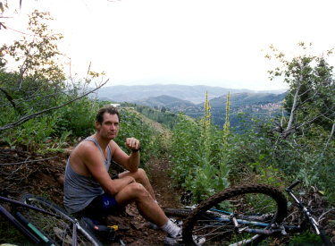
On August 10, 1998, Dehn, Rob, and Mike
arrive at Shadow Lake with Jasmine, Mike's energetic Jack
Russell terrier. This ride was first published in 1998 on the Mad
Scientist Software website and moved to UtahMountainBiking in 2000. |
| Shadow Lake is at 8900 feet elevation, so it won't clear of
snow until mid to late June. The ride requires intermediate skills but
good aerobic capacity. You'll gain 1500 feet of elevation, starting at 6900 from
PCMR parking. Tourists from lower elevations will find the climb
difficult. Because you'll need to find multiple trails within a complex
trail system, a navigation app is highly recommended. The route I
describe here will be 19 miles with 2400 overall feet of climbing,
so it's only for strong riders. View
of Shadow Lake from the Shadow Lake trail. |

|
 |
There is no single trail to get there. You'll need to
connect several trails, both uphill and down. Because the Midmountain Trail traverses the
hill around the middle of the ride, it's possible to select amount several
climbing routes on the lower mountain then take Midmountain to reach your
climbing route for the second half. In the same way, you can select among
downhill options. This page will describe the "new version" of the
classic loop: Sweeney's, Johns, Midmountain, Steps (or Tommy's Two
Step),
Three Candles, Keystone, and Shadow Lake uphill, then Blazing Saddles to
Charlie's 9K, Apex and CMG downhill.
Heading uphill from Midmountain on Tommy's Two Step. |
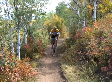
Classic route: Sweeney's Switchbacks then Johns Trail |
 |
This climbing option has 1100 vertical feet of climbing over
3.7 miles to the Midmountain trail. (This is one mile less than climbing
Jenni's trail, for a significantly steeper rate of ascent. See
below.) Note that Sweeney's begins from a different trailhead about
1/2 mile south of Park City Mountain Resort's base, and you'll need to
link up via city streets if your downhill route puts you at PCMR parking.
#1 Sweeney Switchbacks
Sweeney's is 2.1 miles long with 650 feet of elevation gain. It ends on
the Tressle Trail, but we'll only do the first 1.8 miles of it because
we'll switch over to John's Trail at the Kings Road connector. (See below
for "getting there" info.)
Bruce heads up the Sweeney Switchbacks in 2001.
|
| Sweeney's has some expert-class stretches when done as a
climb. It's one of the older trails in Park City, built with a fairly
stiff slope and no modern run-off control. So it's had plenty of time to
erode and expose lots of rocks.
A bit of trail on Sweeney, with my bike for boulder
size comparison. It can be a bit rough.
|

|
 |
Sweeney's zigzags up the mountain through fir, oak, and maple
forest with occasional breakouts for views. Pass the Sweeney
Shortcut, Sweeney Cutoff, and Flat Cable on your right. Next pass two
connectors to Sweeney South forking to your left. Pass the uphill
connection to Flat Cable on your left. Then at mile 1.8, turn to the left
on the Kings Road connector and quickly turn to the right uphill on lower
Johns.
Breaking out of the aspen forest as we approach the
junction with Johns trail.
|
| #2 Johns Trail
From Sweeney's begin the climb through the forest at the Johns trail
fork. Johns Trail is 1.9 miles long with a bit over 400 vertical feet of
climbing. This trail also requires upper-intermediate skill because of
tight riding in the trees with many roots to bump over.
Handlebar view of Johns dense aspen forest.
|

|
 |
After 1/3 mile, pass the 4:20 trail. (To the right connects to
Sweeney, left is 420 to King Road. A second connector to 4:20 is on your
left at the next right-hand switchback uphill. From here, just keep
rolling the countless turns through the aspens.
The trail twists and turns, bouncing over horizontal
aspen trunks.
|
| At the top, you'll come to an open area where several trails
and Drift Road come together. Jenni's arrives from downhill, Johns 99 from
the south. Keep straight and find the connector to Midmountain. It will be
0.2 miles on the connector to reach Midmountain. Now you'll turn to the left if you'll be
climbing Tommy's, or right if you intend to follow the classic route up
Steps.
Here's a sample of the trail surface on Johns. Narrow
squeezes and turns in the trees.
|

|
Easiest alternative climbing option: Jenni's Trail |
 |
Jenni's trail starts at Park City Mountain Resort's main parking and
climbs to the Drift Road area where you can make connections uphill. It's
suitable for all experienced riders. Jenni's is a one-way uphill trail, so
plan another route for your return to base.
Jenni's trail is 4.7 miles to the Drift Road connection area (with
another 0.4 miles around the hill to the ski lift). You'll climb 1200
vertical feet.
Looking uphill on Jenni's trail as we cross a ski
slope to the next aspen grove. |
| Jenni's trail has a gentle rate of climb and -- unlike the
Sweeney's/Johns combo -- the trail surface is mostly free of bumps and
large roots. It's an easy way to save your energy for the higher
elevations.
At the top of Jenni's, veer to your right to find the connector to the
Midmountain trail. Assuming you're looking for the easier way up, when you
hit Midmountain in 0.2 miles, fork left (south) and you'll quickly reach
Tommy's Two Step.
Jenni's lies in maple and aspen forest, with
occasional fir trees. |

|
Easy alternative climbing option: Mother Urban |
| Mother Urban is a one-way climbing trail. It will start in
the same area as Sweeney's. There's still ongoing construction at the
bottom, so at this time you can only climb it if you connect to the
completed upper portion from Sweeney's and Gravedigger. I will have
updated information on Mother Urban in late summer 2022 when trailwork is
complete. |
Intermediate alternative climbing option: Armstrong |
 |
The Armstrong Trail and Spiro start uphill just north of the
Park City Resort main parking. You can connect via the 0.8-mile Silver
Spur trail. (When Silver Spur hits Spiro, you'll need to go downhill a bit
to get on Armstrong.
Spiro is a shorter, faster, and steeper option to Armstrong, but it's
heavily used by downhillers and hikers. So I recommend Armstrong. Looking
back at a climbing turn on Armstrong. Most of the ride is in heavy forest
or maple, aspen and fir. |
| Armstrong is a one-way uphill-only trail, 4.5 miles long
with 1250 vertical feet of climbing. Pass the Ham trail on your left as
you near the top, then fork to the left on Midmountain. You'll need to
ride Midmountain 4.6 miles to reach Tommy's or Steps, passing the top of
Spiro after 1.8 miles and crossing CMG in 2.8. Pass the downhill end of
Mojave on your right. The Armstrong option is a bigger-mile ride with a
total 9.1 miles before you start the second part of the climb. The Steps
trail, then
Tommy's, will be on your left.
Near the Ham trail intersection, we're looking across
the valley from Armstrong at the resort ski slopes.
|

|
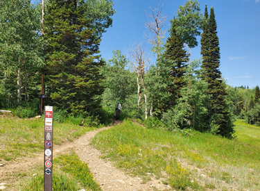
Connecting at Midmountain |
 |
The Silver King area is the staging spot between the lower
climb (to Midmountain) and the final climb to Shadow Lake. Unless you're
already on Midmountain, find the "trail confluence" on Drift
Road and take the 0.2-mile connector trail uphill to the Midmountain
trail.
The Silver King mine at the top of
Johns. |
Midmountain to Shadow Lake |
Classic route: Steps (segment #1) |
 |
Steps begins on the Midmountain Trail just north of the connector from
Silver King (a right turn from the connector). On some maps, the first
portion is titled as "Steps Connector." There's also a connector
from Tommy's to Steps if you want to change climbing routes mid-way.
It's 1998. We
haven't even made it up Steps yet, and it's time for another break. A
younger version of Bruce sits next to old-fashioned hardtail bikes. |
| From Midmountain to the Yurt, Steps is 1.2 miles long with
around 450 feet of elevation gain. That's a moderately stiff rate of
climb, with a fairly continuous grade. Steps is an older trail, so there
will be some areas of embedded boulders to bang over.
Rolling through aspen forest on Steps.
|

|
 |
The trail will alternate between low scrub and aspen forest.
At the top, Tommy's Two Step will join on your left. Continue to the open
area where two gravel roads cross near the yurt restaurant. Veer right uphill and
find the Three Candles trail leaving Thaynes Road.
View down toward the Silver King area from Steps.
|
New easier route: Tommy's Two Step (segment #1) |
 |
Tommy's Two Step is 1.5 miles long and it's an uphill-only
trail. (Mojave is an alternative for the downhill.) Tommy's is a newer smoother
trail than Steps, and it spreads the 450 vertical feet of climbing over an
extra 1/3 mile. It begins on the Midmountain Trail around 0.2 miles
south of the connector from Silver King.
The entry to Tommy's from the Midmountain trail.
|
| Tommy's Two Step is also a more interesting trail to ride
than Steps. The trail rolls in and out of an aspen and fir forest strip
that lies between two ski slopes, then crosses the ski slope into forest.
Crossing a ski slope and re-entering the forest.
|

|
 |
The terrain is mostly aspen forest, with an occasional fir
and maple. The trail is mostly smooth dirt. There will be downhill views
whenever the trail happens by a ski slope.
Passing across the ski lift corridor with breakout
views to the northeast.
|
| When Tommy's reaches a broad ski track, curve to the left
and join the Steps trail as you head 100 feet uphill to the intersection
of gravel Thaynes Road and Meadow Road. There will be a restaurant yurt to
your right. Keep left of the yurt and cross the intersection of the two
roads heading uphill. Find Three Candles on the far side of Thaynes Road.
(Mojave, a downhill-only trail, is on the right side of the yurt off
Meadow Road. This is one of several options for your downhill return.)
Almost to the top.
|

|
 |
Three Candles begins on Thaynes Road at the yurt. It's 0.8
miles long, with around 250 feet of elevation gain.
Three Candles as seen from Thaynes Road.
|
| Three Candles is a newer trail with plenty of wiggles as it
climbs on smooth dirt surface. It's a fairly easy ride with barely
perceptible climbing. The trail will cross a ski slope or two, with more
open views than what you found lower on the mountain.
Two riders head across the ski slope as I climb Three
Candles.
|

|
 |
Three Candles ends on the Keystone Trail. Fork to the right.
You've now done 99% of the climbing to Shadow Lake, so enjoy the cruise
for the next couple of miles.
Looking back at Three Candles from the Keystone trail
intersection.
|
 |
Keystone is 2.9 miles in total length, but we'll only ride
the 1.7 miles from Three Candles to the Jupiter Access gravel road near
Shadow Lake.
Keystone is a very easy trail to ride. And it's
pretty.
|
| This portion of Keystone is a traversing trail, following an
old cut on the side of the slope. There's little change of
elevation as it heads straight toward Shadow Lake.
The riding surface is smooth and easy. There will be an occasional
breakout view into Thaynes Canyon below. Be sure to spot the old mine.
Looking down from Keystone into Thaynes Canyon.
|

|
 |
When you hit the Jupiter Access road, turn right downhill on
the doubletrack if you plan to visit the lake itself. It's only around 100
yards away, although you can't see the lake from the road intersection.
If you're heading uphill around the lake, connect to the Shadow Lake
singletrack trail on the other side of the road. Cruising
on Keystone. |
Doubletrack spur to Shadow Lake and connection uphill |
|
Shadow Lake lies just off the Jupiter Access road. When
the Jupiter Access road turns downhill into Thaynes Canyon, there's a
doubletrack that climbs north of the lake. It will connect to the uphill
end of the Shadow Lake trail, the downhill end of Blazing saddles (which
is your route to Charlie's 9K trail), and Scott's Pass on the
Wasatch Crest.
You can ride the Crest access doubletrack, or backtrack to
the Shadow Lake singletrack on Jupiter Acess for your return trip.
Bruce at Shadow Lake in 1998. Hardtail,
soft body.
|

|
Shadow Lake and connections uphill |
 |
The old classic route used Jupiter Access to climb to the
Apex trail for the descent. You can still do that. But I suggest you take
the singletrack route on Shadow Lake, Blazing Saddles, and 9K over to
upper Apex.
Segment #1: Shadow Lake singletrack
From the Jupiter Access road, head west on Shadow Lake. Shadow Lake is
0.8 miles long, with 250 vertical feet of climbing to an elevation of
9300.
The lower end of Shadow Lake on Jupiter Access road. |
| The Shadow Lake trail will curve around the lake as it
climbs. The trail is fairly smooth and non-technical with a gradual rate
of climb. There will be only one spot where you can see the lake, so get
your picture.
View of Shadow Lake from the trail.
|

|
 |
Ignore the steep trail on your left as you approach the end
of Shadow Lake. When you hit the old (overgrown) doubletrack from Thaynes
Canyon to Scott's Pass, make a hard 180 degree turn to get on Blazing
Saddles uphill.
Lush greenery as we curve around the lake at 9000
feet elevation.
|
Blazing Saddles (segment #2) |
 |
Blazing Saddles is 0.6 miles long, running from Shadow Lake
up to Scott's Pass. Go up and back if you want to. We'll ride only the
first 1/4 mile, veering to the left at the trail fork for Charlie's 9K.
The lower trail here is Shadow Lake while the upper
is Blazing Saddles. I'm standing on the doubletrack Crest Connector.
|
Charlie's 9K (segment #3) |
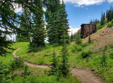 |
Charlie's 9K trail is 5.7 miles long, with 400 feet of
climbing to Empire Pass. And you're welcome to ride most or all of it for
a monster return downhill. But our "classic" Shadow Lake loop ride will fork away at the Apex
trail intersection, so we'll ride only the first 1.7 miles of the 9K
trail.
Looking east as the trail skirts the Little Belle ore
bin. |
| At mile 1.7 from Blazing Saddles, the Apex trail crosses. (FYI,
the uphill portion of Apex gets steep and will merge with the Dead Tree trail to
Jupiter Peak.) Veer to the left downhill and begin the descent on Apex.
We're at the Apex trail intersection. Fork left
downhill.
|

|
 |
From Charlie's 9K the Apex trail will descend 1.8 miles and
550 vertical feet. It will cross several ski runs on the way down as it
weaves in and out of aspen and fir forest. Shortly after leaving 9K, Apex will cross the Jupiter Access road. At
1.2 miles down, it will cross the Keystone trail. (Keystone and its
connecting trails are another alternate descent. Three Candles is just a
little bit away on Keystone to your right. This can take you to the top of
Mojave.)
Rolling across a ski slope on Apex. |
| Apex ends on the Thaynes Road. Turn hard
left downhill on the doubletrack and coast down to the entry to the CMG
trail 0.4
miles later.
Apex reaches Thaynes Road. A hard-left turn on the
doubletrack will take us down to the top of the CMG trail.
|

|
CMG -- Crescent Mine Grade (segment #5) |
 |
The CMG is 4.5 miles long, descending 1600 vertical feet.
Part of the trail is one-way downhill. It will end at the main Park City
Resort parking. On the way down, it will temporarily join the Midmountain
Trail for around 100 yards. The trail signs are there, but small. It's a
good habit to always read and understand every trail marker as you ride.
Entry to CMG (where the camera is placed) from upper
Thaynes Road.
|
| CMG follows an old ore-wagon grade, so it's a fairly smooth
ride with a gentle slope. It's an easy-intermediate ride overall. The
trail will cross several ski slopes but spends much of its time in fir and
aspen forest.
This photo shows the CMG trail lying in the middle of
an old bench-cut mine grade in aspen forest. |

|
 |
If you don't want to take CMG all the way downhill, you can
traverse on the Midmountain trail to your target trail. There's also a connector called Eagle that joins
lower CMG to lower Spiro.
Meandering trail crosses a flat.
|
Spiro alternate descent from Midmountain (segment 5-B) |
 |
Spiro is the most popular alternative descent. You'll first
need to descend to the Midmountain Trail. Make a hard left turn from CMG
onto Midmountain and pedal 0.9 miles north. Now turn right downhill on
Spiro. You'll drop 1200 feet over 3.2 miles to a spot just north of the
PCMR parking. Turn right on Silver Spur for a singletrack connection back
to the resort base.
Bruce heads downhill on Spiro in 2003.
|
Bottom Line!
This is a satisfying ride for strong intermediate riders or experts. Using
the less-steep options on the loop described above and riding above Shadow
Lake to Charlie's 9K, the ride will be 19 miles with 2400 feet of overall climbing. You'll hit some of the prettiest
trails in Park City without gnarly technical challenges.
View from Steps down toward the ski
lifts near the top of John's Trail. |

|
|
Getting there:
Jenni's Trail uphill,
Crescent Mine Grade down. On Park City's main drag, turn towards
Park City Mountain Resort (PCMR). Turn right on Empire then veer right
again at Silver King Drive. Pull into the big parking lot. Pedal
southwest across the parking lot, toward the Payday lift and the Alpine
Slide. Find the gravel road on the edge of the parking lot, heading
southwest between the First Time ski slope and the buildings.Continue
uphill.
|
 |
Armstrong/Spiro Trail. On Park City's main drag, turn towards
Park City Mountain Resort (PCMR). Turn right on Empire then veer right
again at Silver King Drive. Pull into the big parking lot. Start pedaling.
Go north out of the parking lot onto Silver King Drive and turn left
toward the mountains. Turn right onto Three Kings. The next
left will be Crescent Drive. Pedal about 1/4 mile uphill on Crescent. The trail is the singletrack
at a blocked-off paved area on your right where Crescent
Drive turns left. N 40° 39.390' W 111° 30.895'
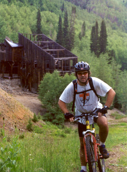
Mike, an emergency physician living in Park
City, cranks past the ruins of the Jupiter mine. August 10, 1998.
|
| Sweeney Switchbacks. On Park City's main drag, turn towards
Park City Mountain Resort. Turn right on Empire then veer right again at
Silver King Drive. Turn left on Lowell, then pull right into the parking
area. Park. Pedal back out of the parking lot onto Lowell and turn right,
uphill. Keep straight past the resort. When
you reach the spot where the road turns around in a loop, the doubletrack
straight ahead is the trail. (Do NOT park in the neighborhood!) N 40° 38.785' W 111°
30.076' |

|
Only those trails that would be of interest to most riders
to Shadow Lake are labeled on this map.
Park City has a huge and very detailed map showing almost
all of the complex interconnecting trails in the area. It's free (at least
for the years 2002-2011) at Park City bike shops. A $10 donation is appreciated to support
this important service.
An on-trail app such as Trailforks (a subscription is a bargain) can be
very valuable when navigating the complex Park City trails.
|
|


