 |
Mill Creek Canyon Trail
includes Wasatch Crest climb
The Mill Creek Canyon trail follows Mill Creek Canyon from
the Big Water area of upper Mill Creek to the ridge between the Salt Lake
Valley and Park City. It makes connections to Dog
Lake, to the Midmountain
Trail via the Crest Connector, and of course, the Wasatch Crest trail. It
is part of the Great Western Trail system.
Mike Engerberson looks at the view as the trail reaches the Wasatch Crest. Photo
and original trail review September 18, 1999 by Bruce.
Latest update to this page August 8, 2022.
|
| Upper Mill Creek Canyon (above the Upper
Pipeline trail) is closed to bikes on odd-numbered days. Bikes
are allowed on this trail ONLY on even-numbered days! Dogs are
allowed here, but must be on-leash on even numbered days, and must always
be kept in direct control. The gate to the upper Canyon (above Burch
Hollow) is open July 1 to October 1.
Riding in the shade of fir forest. We're between the
Dog Lake and the Little Water trail forks, heading uphill. On the lower
trail, the path contours the hillside above the main canyon, wandering
through side drainages.
|

|
 |
From the lower Big Water trailhead to the junction with the
Wasatch Crest trail and the Crest Connector to Midmountain, the Mill Creek
Canyon trail is 4.7 miles long. Over this distance, it climbs 1300
vertical feet to a top elevation of 8875 feet.
As the trail approaches the top, the grade lessens
and there are some meadows to cross. In this area, the trail follows close
to the creek. |
| For the most part, the trail is wide and smooth, but with
occasional roots to bang over. It is suitable for strong experienced
beginners. The rate of climb on some sections of the trail may be too much
for less-fit riders.
The terrain is mostly a mix of aspen and fir forest.
There are only occasional views until you approach the top.
|

|
 |
Mill Creek is used both as an uphill for strong riders, and
as a shuttled downhill from the Wasatch Crest for everybody else. This
trail page will also describe the climbing route on the Crest.
We've reached the top of Mill Creek and are now
climbing uphill on the Wasatch Crest trail southbound. The riding here is
significantly tougher, both in tech requirement and overall trail
steepness. |
 |
Trailhead
You can start uphill on Mill Creek from either the lower or
upper Big Water trailheads. (You can also arrive at this spot by climbing
the Upper
Pipeline from the Elbow Fork area.) I recommend the lower trailhead,
where the lower Big Water trail begins. All distances reported on this
page are from the lower trailhead.
The Big Water trail begins at the lower Big Water
trailhead at the top of Mill Creek Canyon for the up-and-back lariat ride. |
| Via Wasatch Crest
Most riders will pay for a shuttle to Guardsman and ride the
Wasatch Crest
trail to the top of Mill Creek Canyon. It is 8.3 miles from the top of Scott's
Bypass trail -- at Guardsman Pass -- to the top of the Mill Creek
Canyon trail and its fork with the Crest Connector.
Looking north downhill as the Wasatch Crest trail
begins to descend from the ridge between Big Cottonwood Canyon and Mill
Creek Canyon
|

|
 |
Via Mill D North Fork
Many riders make a loop ride that includes a climb up Mill
D North Fork from Big Cottonwood Canyon, descent on the Wasatch Crest
and Mill Creek, and a connection back over the ridge via Dog
Lake.
Trail fork on the Mill D North Fork trail, with a
connection uphill to Dog Lake and from there, to Mill Creek.
|
 |
The Mill Creek Canyon route consists of the lower Big Water
trail and the Great Western trail above the Dog Lake trail fork. It ends
on the ridgeline where the Crest Connector to the Midmountain Trail and
the Wasatch Crest trails continue. It's 4.7 miles long with 1300 feet of
elevation gain.
Looking uphill as the Mill Creek trail reaches a
meadow. |
| While this ride description goes all the way to the Wasatch
Crest, you can make shorter rides on this trail, for example Dog
Lake, Red Pine, or just up to the viewpoint over The Canyons and back
(9 miles round
trip). For the Mill Creek to Desolation out-and-back, you'll climb 2300 vertical feet over
the 14 mile round trip, so come prepared to use some thigh! View up the Big Water Trail early in
the ride. Note the wide trail with a root or two, shaded by mature fir
forest.
|

|
 |
Important note: Dogs are allowed on Mill Creek Canyon trails, but don't
take Fido over the ridge into Big Cottonwood Canyon! The last mile of the ride to the
Desolation Lake overlook, you're in the Cottonwood Canyon watershed, where dogs are
absolutely outlawed. If you're caught with a dog in Big Cottonwood, you WILL be busted! Dominic and Jackie hide from a rain shower about 5 miles into the ride.
Good time for lunch. Photo August 1999. |
| As you leave the lower Big Water parking lot, keep straight
as the connector from upper Big Water arrives on your left. Then at mile
0.1, keep left and uphill as the Upper
Pipeline descends on your right.
At mile 0.5, keep to the right as the upper Big Water trail joins from
the upper parking lot. Then at 1.5 miles, the Big Water Trail turns towards Dog
Lake. You'll branch
off to the left on the Great Western (Mill Creek Canyon Trail). Then at mile
1.6, cross the Little Water trail.
The Little Water trail intersection as seen from the
Mill Creek Canyon trail heading uphill.
|

|
 |
The trail will meander in and out of small side-canyons.
There are bridges over three creeks. After the Dog Lake trail fork, the
pitch gets tougher for around a mile, but it's still pretty mellow
compared to what you'll encounter on the Wasatch Crest.
The terrain alternates between aspen and fir. The
aspen areas often have luxurious undergrowth.
|
| At mile 3.4, the Mill Creek Canyon trail enters a large
meadow. There will be a bridge across Mill Creek. Just uphill from that
bridge, the Mill Creek Meadows trail
comes in on your right. This trail fork is unmarked in 2022. (Mill Creek
Meadows descends from the Wasatch Crest.)
The big meadow -- and the bridge over Mill Creek --
as seen from uphill.
|

|
 |
After passing through the meadow, the trail goes back into
forest. In 0.2 miles the Red Pine Road trail
forks away on your left. Red Pine is an alternate descending (or climbing)
route from the upper Mill Creek parking.
Looking north as the Red Pine Road trail leaves the
Mill Creek Canyon trail.
|
|
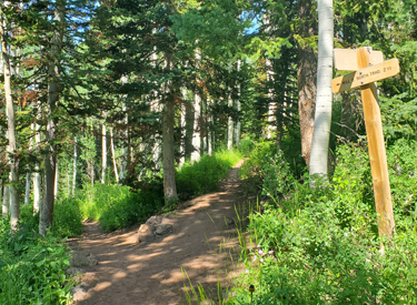
At 4.7 miles, the trail reaches the Crest. On your
left is the Crest Connector to the Midmountain
Trail, used for long loop rides. To the
right is the Wasatch Crest. It looks easy, but it will get tough. This is
a good spot for a turn-around for intermediate riders. Your ride will be
9.4 miles with 1300 vertical feet of climbing. Not bad.
From a rare open spot in the
trees, we're climbing up toward the ridge. Still a mile to go. |

|
 |
If you're ready for some tough stuff, turn right (south)
and continue the climb on the Wasatch
Crest. Your destination might be Desolation Lake at 9,800 feet
(another 2.5 miles and over 800 vertical feet of climbing) or Mill
Creek Meadows for a downhill or the Mill D
North Fork trail.
Arriving at the trail fork for the Crest Connector
(to the Midmountain Trail) on the left and the Wasatch Crest itself on the
right.
|
Wasatch Crest trail uphill |
|

|
If you continue uphill from the Crest Connector trail fork, you'll have
a bit of an adventure. The climbing gets tough at this elevation and
there's some technical rock to navigate. For the first two miles, the
trail follows an old road-cut on the Mill Creek side of the ridge between
the Salt Lake Valley and Park City.
Climbing through aspen forest on the Wasatch Crest. |
| Most riders do Upper Mill Creek as an out-and-back: 6.5 miles to the
Desolation Lake overlook, then a lightning-fast 6.5 mile return descent down the same
trail.
On the upper mountain, there are
occasional breakouts from the aspen and fir forest. You'll encounter
chokecherry, elderberry, currant, as well as daisies, lupine, geranium,
and many other wildflowers. |

|
 |
For even more awesome alpine views and high-elevation
riding, continue from the Desolation Lake viewpoint another 3.4 miles along the Wasatch Crest before your
turn-around at the top of Puke Hill, for a 20-mile round trip. From the top of Puke Hill, you can descent to Park City's Midmountain
Trail via Pine Cone Ridge for a loop ride
or connect to Charlie's 9K trail via Blazing
Saddles.
Looking toward the ski resorts and Red Pine Lake
above Park City. |
| Watch out for descending riders. Many riders will be riding Mill Creek as a downhill from the
Wasatch Crest, and they may not yield to you.
Gary Argyle
(Bruce's #4 son)
rides the ridgeline between Park City and Mill Creek on the way to Desolation Lake. The
red blossoms are Mountain Paintbrush. Photo August 1999.
|
 |
 |
At mile 1.8 from the Crest Connector trail fork, the Mill
Creek Meadows trail forks away on your right.
At mile 1.9, you'll reach the ridge between Big Cottonwood and Mill
Creek. No dogs beyond this point!
We've reached the watershed boundary
between Mill Creek and Big Cottonwood. No dogs past this spot! Photo 2012. |
|
Desolation Lake is an example of a glacier lake, formed within a cirque
and dug down by the moving glacier. (Note the circular form of the small
canyon within which Desolation Lake resides.) When the glacier melted
(around 10,000 years ago), the depression filled with water.
This view is worth the vertical feet you'll climb to get there
(2300 feet, to 9800 ft. elevation)! Here's Dominic.
|

|
Other descending options! |
 |
While there's nothing wrong with an out-and-back, many
riders want to do a loop or figure-eight ride. For alternate descending routes, see my trail pages on Mill
D North Fork and Dog Lake, Mill
Creek Meadows, and Red Pine.
Cruising the Wasatch Crest toward
Desolation Lake. |
| The Desolation Lake to Dog Lake return is a popular option.
Drop down the Desolation Lake (Mill D North
Fork) trail. Intersection of the Crest with the Desolation
Lake trail is GPS N 40° 39.508' W 111° 35.756'.
We're finally on the Crest and looking
south toward the granite peaks of the mouth of the Cottonwood canyons. |

|

|
Descend Mill D North Fork for about a mile and a half, then fork to the
right on the new (2017) connector trail to Dog Lake.
Pedal a mile gently uphill on the connector, then turn right again to
pedal past Dog Lake and descend the Big Water Trail.
In this photo, we're descending Mill Creek and have
reached the meadow where the Mill Creek Meadows trail joins the Great
Western. |
|
Option: If you want a bit more climbing, you could pass the first Dog Lake
connector trail. After 2 miles and 1400 vertical feet of downhill on Mill D
North Fork, turn right towards Dog Lake at GPS N 40° 39.731' W 111° 37.733.
The Dog Lake to Mill D Connector has been rebuilt and is now a reasonable
climbing route. At the top, ride past Dog Lake and pick up the original trail 1-1/2 miles
later, then finish the last 1-1/2 miles down Big Water to the trailhead.
Cruising the Wasatch Crest toward
Desolation Lake in 1998. |

|
 |
Getting there: Get to Foothill Blvd on the east bench of
Salt Lake City via I-215. Exit at 39th South. Take 3800 South eastbound into the Canyon.
Mill Creek user fee is $5 per car as of 2022, payable by credit card as
you leave the canyon. Drive all the way to the top of the canyon. The trail begins on the south end of the Big
Water Trailhead parking area GPS N 40° 40.922' W 111° 38.914'. (Note: the gate to upper
Mill Creek Canyon is open to cars July 1 to November 1. Mountain bikes are only allowed on
upper Mill Creek trails on EVEN numbered days!)
There are bathrooms at the Big Water trailheads. |
| Quickie overview of the Wasatch Crest ride as published in
1998. For a closeup of the alternate routes
around the Big Water Trail, go to the Dog Lake page.
For more details on the Pipeline (upper and lower) see the Mill
Creek Pipeline trail page. |

|
|


